The City of Cape Town plans to redevelop its Central Business District (CBD), creating a brand-new neighbourhood and promenade while addressing the metro’s notorious congestion issues.
Earlier this month, Cape Town Mayor Geordin Hill-Lewis announced that the City plans to build a new link bridge and tunnel to improve traffic flow while freeing up valuable land.
This plan will see the famous Foreshore Freeway, one of Cape Town’s most distinctive landmarks, finished after more than 50 years.
The mayor explained that Cape Town has limited space to expand given its geographical constraints, as the city is wedged between Table Mountain and Table Bay.
However, he said that the little available land they have is underutilised, and that the existing road infrastructure has effectively created a physical barrier separating the city from the sea.
“With our city centre wedged into this relatively small piece of land between mountain and ocean, the geography that makes Cape Town so beautiful and so memorable is also one of our greatest constraints. There is very little room for the CBD to expand,” Hill-Lewis said.
“But not all of that constraint is natural. Some of it is man-made. The elevated highway bringing people in from the N1 and N2 – including the famous unfinished freeways – has cut the city centre off from the ocean.”
“This road infrastructure has sterilised the last available inner-city land and left Cape Town with a physical barrier between city and sea, effectively separating us from our maritime identity.”
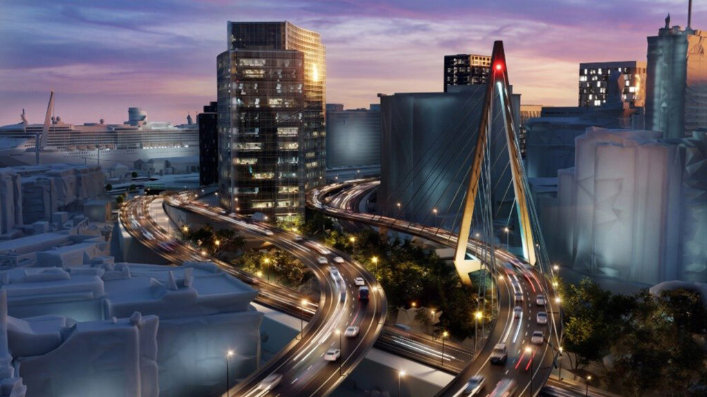
The City therefore plans to complete the Foreshore Freeway and free up 15 hectares of land in the CBD, which will be turned into a new mixed-use area with residential blocks, restaurants, and a walkable promenade.
“[The Foreshore Freeways] are not just bridges. They will help address some of Cape Town’s biggest congestion headaches, while unlocking huge investment, job creation, and more affordable homes for Capetonians,” the mayor said.
“The project will transform Cape Town’s unfinished highways into a new link bridge and tunnel to relieve inner city congestion and fix the connection between the foreshore and the seaboard.”
“And most importantly, over the decades ahead, a brand new vibrant Foreshore neighbourhood will be unlocked, including affordable housing, walkable streets, and a tree-lined promenade along the harbour’s edge all the way to Sea Point.”
How the bridges will be built
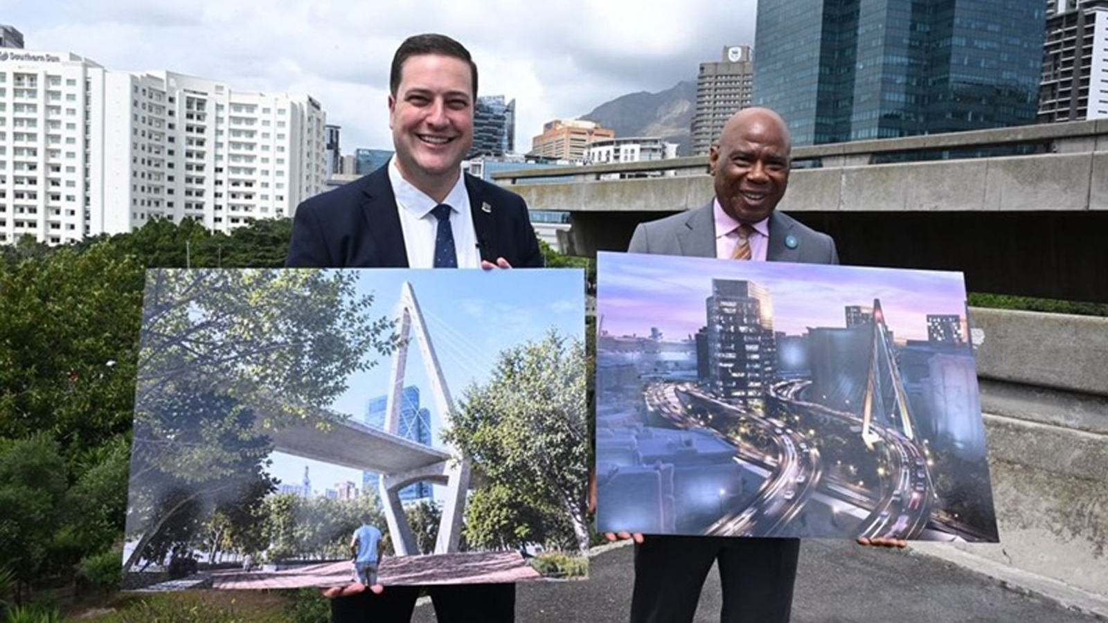
The City unveiled drawings of the proposed bridges during the announcement and confirmed that it would launch a public consultation process.
These designs will be turned into detailed engineering designs, after which a procurement process will be launched and construction will finally begin.
The project will be built in two halves to minimize the disruptions to the existing freeways while construction is underway.
“During the first phase of construction, an iconic new bridge will be built over Buitengracht, and the incoming elevated freeway will be widened, linking the inbound freeway directly to Helen Suzman Boulevard,” said the mayor.
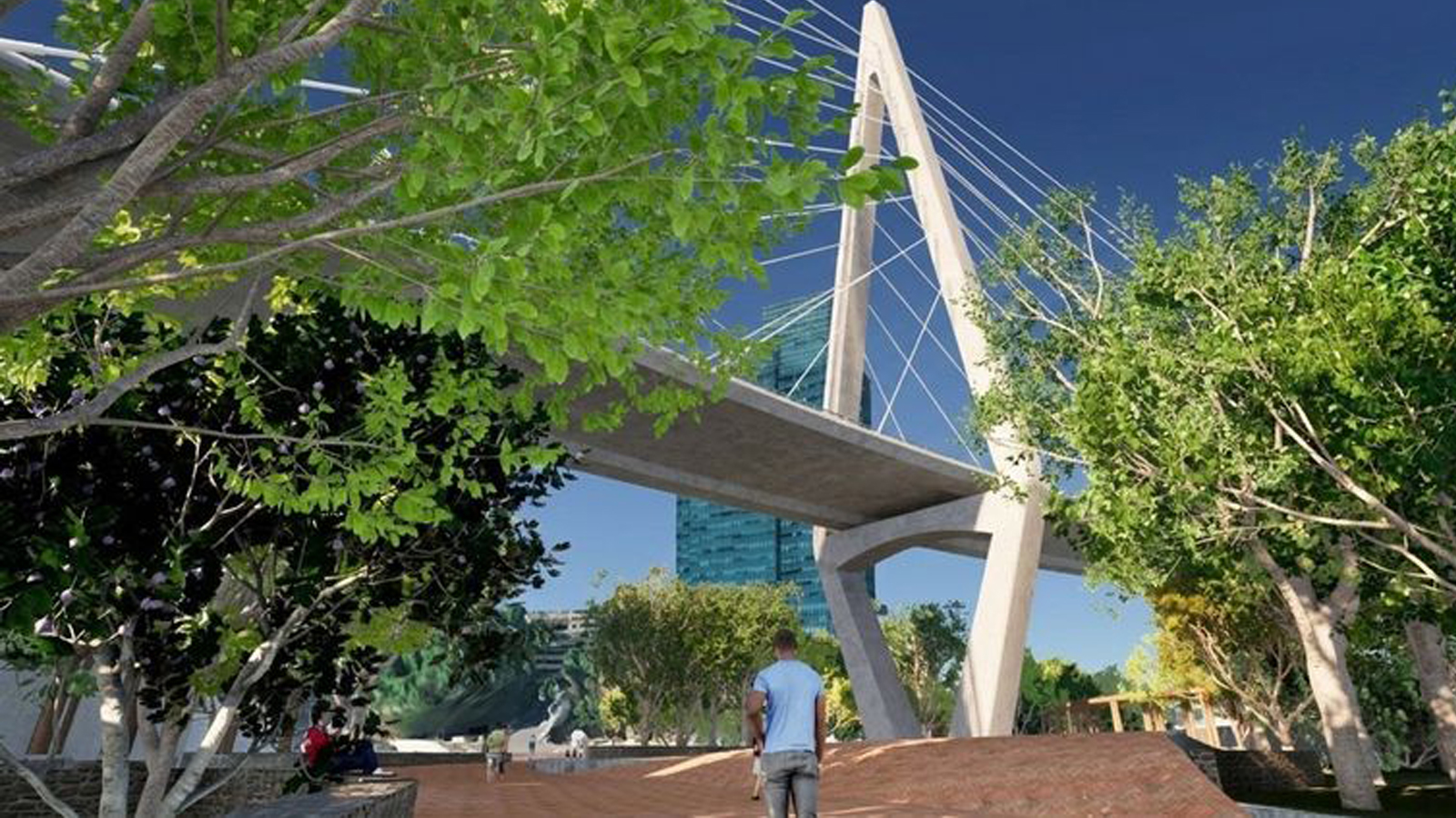
He explained that this will include a large new public park and public spaces below, while motorists heading from the foreshore towards Green Point and Sea Point will effectively bypass the CBD altogether.
“In the second phase, an outbound tunnel will be constructed, with the existing outbound elevated freeway being demolished. This will enable the creation of a new promenade and a brand-new Foreshore neighbourhood.”
Hill-Lewis said that this project will take the better part of a decade to complete, while the new neighbourhood is expected to gradually develop over the next 20 to 30 years.
The City stated that it is currently engaging with Transnet’s Port Authority, which owns the land where it plans to build the tunnel south of Duncan Road.
Cape Town’s mayoral committee provided a full summary of the project:
Phase 1
- Commence construction during the next term of office of Council
- Include two additional inbound lanes on the freeways
- Construction of the link bridge from the inbound freeways to Helen Suzman Boulevard
- New elevated outbound ramp to connect Buitengracht over Dock Road to the existing outbound freeway
- FW de Klerk Boulevard becomes a pedestrian-oriented street
- A new canal links Buitengracht Park to the V&A Canal
- A new park is created under the Buitengracht link bridge
- Bus lanes are implemented across Buitengracht
- Three land parcels become available for a new residential area
Phase 2
- A new outbound bridge that links Helen Suzman Boulevard with the outbound tunnel
- The tunnel is constructed on vacant land between the Port and Customs House, from where it will continue next to Duncan Road to link with the N1 and the N2 freeways
- The outbound elevated freeway viaduct is demolished
- The creation of the promenade, parks and public spaces along the harbour edge
- All of the remaining land parcels become available for development
- Construction of this larger phase to run until 2040
The City said it will announce further public participation and engagement opportunities as they become available in the coming months, including road scheme amendments, heritage impact assessments, and other statutory requirements.


 Loading ...

-2026.10.webp)